- Home
- Product Categories
- GPS Boards
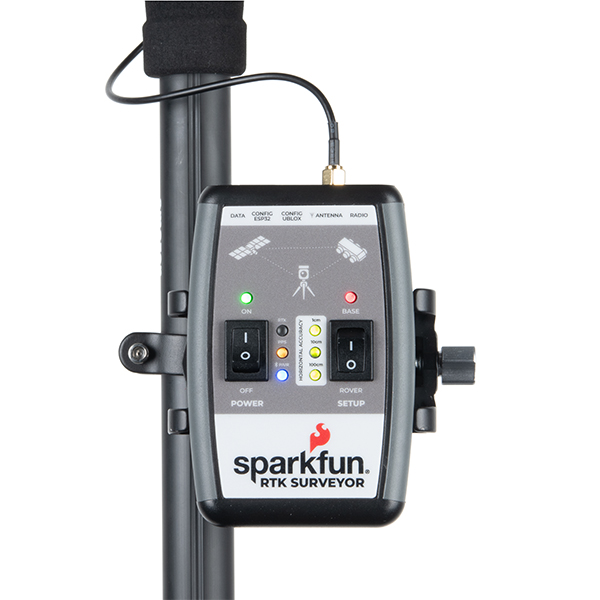
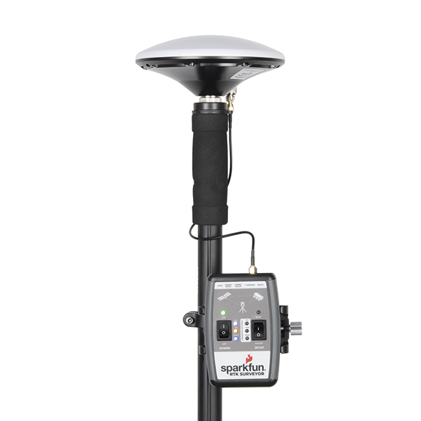
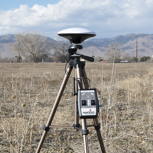
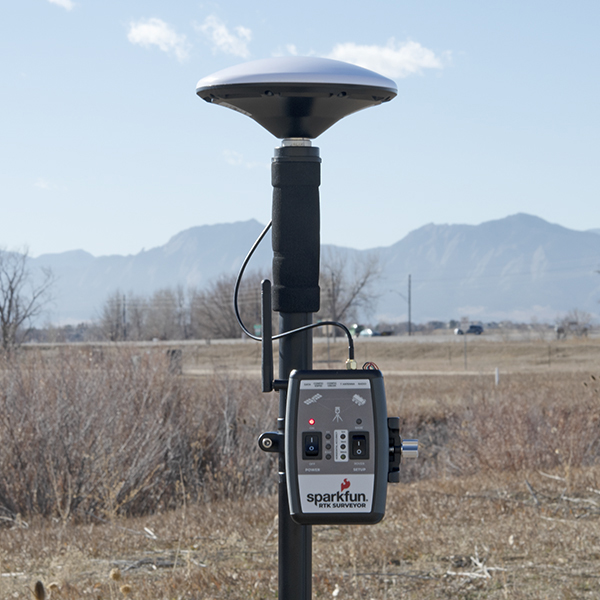
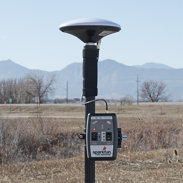
- SparkFun RTK Surveyor

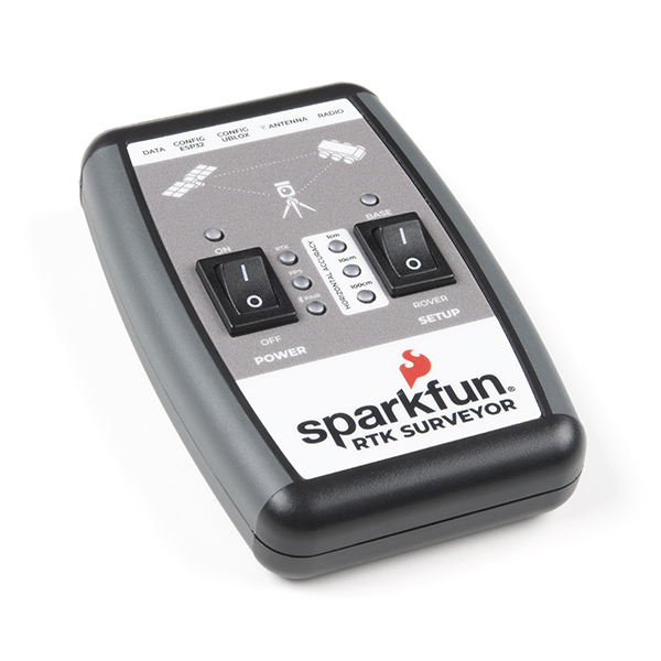
SparkFun RTK Surveyor
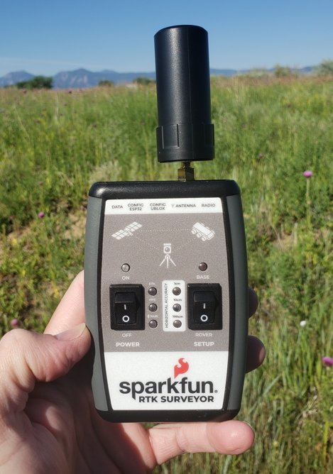
The SparkFun RTK Surveyor is an easy to use GNSS receiver for centimeter-level positioning. Perfect for surveying, this preprogrammed device can also be used for autonomous driving, navigation, asset tracking and any other application where there is a clear view of the sky. The RTK Surveyor can also be used as a base station. With the flick of a switch, two RTK Surveyors can be used to create an RTK system capable of 14mm horizontal positional accuracy. The built-in Bluetooth® connection via an ESP32 WROOM enables the user to use the RTK Surveyor with their choice of GIS application on a phone or tablet. The built in battery allows field use for up to four hours and is compatible with common USB battery banks.
The RTK Surveyor works with common GIS software for Android and iOS including SW Maps Android / iOS, Field Genius, SurvPC, Survey Master, Vespucci, QGIS, QField, and any GIS software that supports NMEA over Bluetooth.
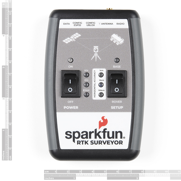
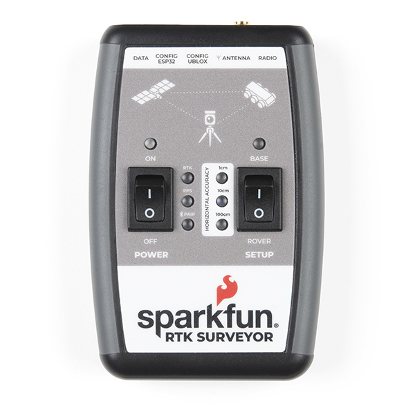
This device can be used in four modes:
- GNSS Positioning (~30cm accuracy)
- GNSS Positioning with RTK (1.4cm accuracy)
- GNSS Base Station
- GNSS Base Station NTRIP Server
In Position mode the device receives L1/L2 signals from a user-provided antenna and the high-grade GNSS receiver provides lat/long and altitude with accuracies around 300mm.
In Positioning with RTK mode the device receives L1/L2 signals from the antenna and correction data from a base station. The correction data can be obtained from a cellular link to online correction sources or over a radio link to a 2nd RTK Surveyor setup as a base station.
In Base Station mode the device is mounted to a temporary position (like a tripod) and begins transmitting correction data over a radio or internet connection. A base is often used in conjunction with a second unit set to 'Positioning with RTK' to obtain the 14mm relative accuracy.
In Base Station NTRIP Server mode an antenna is mounted to a semi or permanently fixed position (like a roof), a cable is run indoors, and the device connects over WiFi to transmit the correction data to a NTRIP caster so that any rover can access the correction data over a cellular or internet connection. This type of base is a very easy way to setup a very precise absolute correction source.
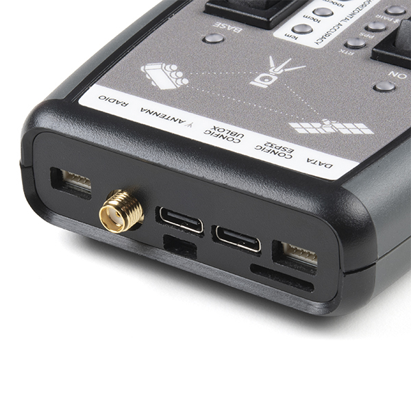
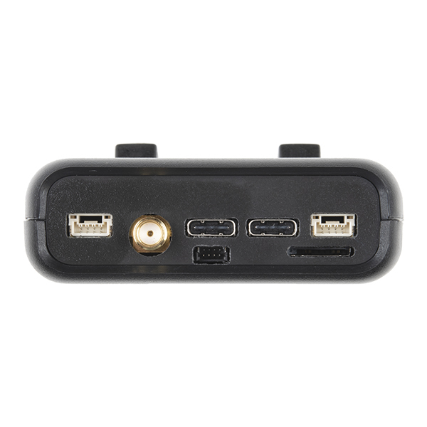
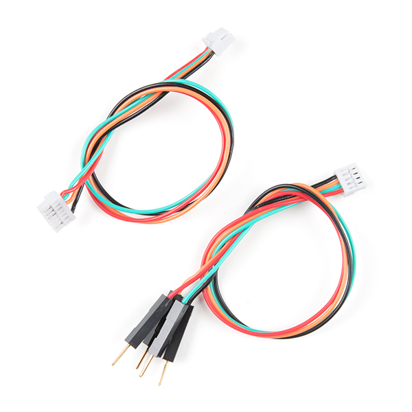
Two cables are provided with the RTK Surveyor allowing a user to plug on our easy to use Serial Telemetry Radios or their own radio link. If a local correction source is within 10km, a user can also use their phone to provide correction data over the Bluetooth® link (no external radio needed!).
Note: The SparkFun RTK Surveyor is just the enclosed device and does NOT include an antenna, serial telemetry radio, or associated mounting pieces. These items will need to be purchased separately from the Hookup Accessories below.
Important: The SparkFun RTK Surveyor is not designed for permanent outdoor mounting. Please mount the L1/L2 antenna (which we've had outside constantly for over three years in Colorado UV) outside with a SMA cable running to the RTK Surveyor that is located inside or protected from the elements. See Creating a Permanent Base for more information.
Supported GIS Data Collector Software:
- SWMaps (Android and iOS)
- Field Genius
- SurvPC
- Survey Master
- Vespucci
- QGIS
- QField
- Any GIS software that uses Bluetooth SPP or BLE
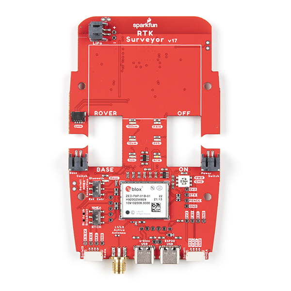
GNSS Receiver: ZED-F9P
- Concurrent reception of GPS, GLONASS, Galileo and BeiDou
- Receives both L1C/A and L2C bands
- Current: 68mA - 130mA (varies with constellations and tracking state)
- Time to First Fix: 25s (cold), 2s (hot)
- Max Navigation Rate:
- PVT (basic location over UBX binary protocol) - 25Hz
- RTK - 20Hz
- Raw - 25Hz
- Horizontal Position Accuracy:
- 2.5m without RTK
- 0.010m with RTK
- Max Altitude: 50km (31 miles)
- Max Velocity: 500m/s (1118mph)
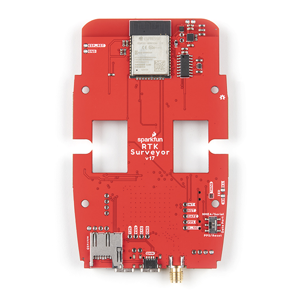
Bluetooth® Transceiver: ESP32 WROOM
- Xtensa® dual-core 32-bit LX6 microprocessor
- Up to 240MHz clock frequency
- 16MB of flash storage
- 520kB internal SRAM
- Integrated 802.11 BGN WiFi transceiver
- Integrated dual-mode Bluetooth® (classic and BLE)
- Hardware accelerated encryption (AES, SHA2, ECC, RSA-4096)
- 2.5 µA deep sleep current
Overall Device
- Internal Battery: LiPo 1000mAh with 500mA charging
- Radio Port: 3.3V TTL Serial (57600bps RTCM TX/RX)
- Data Port: 3.3V TTL Serial (115200bps NMEA)
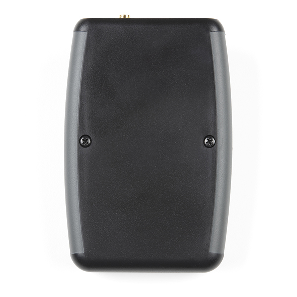
- Weight: 132g (entire device including battery)
- Dimensions: 118mm x 79mm x 30mm (4.7in x 3.1in x 1.2in)
- 1x Qwiic Connector
- 1x microSD Socket for optional logging
- Works with common GIS software including: SW Maps, SurvPC, Field Genius, et al.
Changes: This version (which replaces SPX-17369) uses a reinforced edge mount SMA connector for better resiliency when a fixed 'stub' antenna is used.
SparkFun RTK Surveyor Product Help and Resources
Core Skill: Programming
If a board needs code or communicates somehow, you're going to need to know how to program or interface with it. The programming skill is all about communication and code.
Skill Level: Competent - The toolchain for programming is a bit more complex and will examples may not be explicitly provided for you. You will be required to have a fundamental knowledge of programming and be required to provide your own code. You may need to modify existing libraries or code to work with your specific hardware. Sensor and hardware interfaces will be SPI or I2C.
See all skill levels
Core Skill: Electrical Prototyping
If it requires power, you need to know how much, what all the pins do, and how to hook it up. You may need to reference datasheets, schematics, and know the ins and outs of electronics.
Skill Level: Rookie - You may be required to know a bit more about the component, such as orientation, or how to hook it up, in addition to power requirements. You will need to understand polarized components.
See all skill levels
Comments
Looking for answers to technical questions?
We welcome your comments and suggestions below. However, if you are looking for solutions to technical questions please see our Technical Assistance page.
Customer Reviews
5 out of 5
Based on 3 ratings:
1 of 1 found this helpful:
works great with minimal effort
Using with one of the suggested antennas (GNSS Multi-Band L1/L2 Surveying Antenna (TNC) - TOP106 GPS-17751) and SW Maps on an Android phone. Seems to be accurate within ~3' of "known" survey marker. Easy set up.
Consistent accuracy!
This really harnesses the power of F9P chip.
Hi, is it any other app to be used with this SparkFun RTK Surveyor than SW Maps? There are some features like gauss-kruger projections not available in SW Maps and I would know if there is another app.
Is there a list of SparkFun RTK compatible apps?
thanks a lot
Hi, I have a question is it posible to restar the fabric value (original function) for esp32. The problem was when I try to apply wifi function that is described in ESP32 thing guide. I don’t have enough experience in arduino program. Any information is very helpful. The product works excellent.
Thanks
It looks like you've purchased a few units and are asking for technical support. Rather then attempt that in the comments section, please contact tech support. They will get you helped out.